A Story of Sipili digitizing their resources
By Jael Colleen
Sipili is a lively town located in Olmoran Ward and surrounded by the stunning landscape of Laikipia
County. This tight-knit rural community, with support of the Arid Lands Information Network (ALIN), is
undertaking a transformative project of mapping their community. The development of OpenStreetMap
involves the active participation of the community in the mapping process, which is a crucial element
that enables a comprehensive understanding of the town’s needs, topology, demographics, and the
location of significant resources. The OpenStreetMap (OSM) will be a free, open geographic database,
updated and maintained by a community of volunteers through open cooperation.
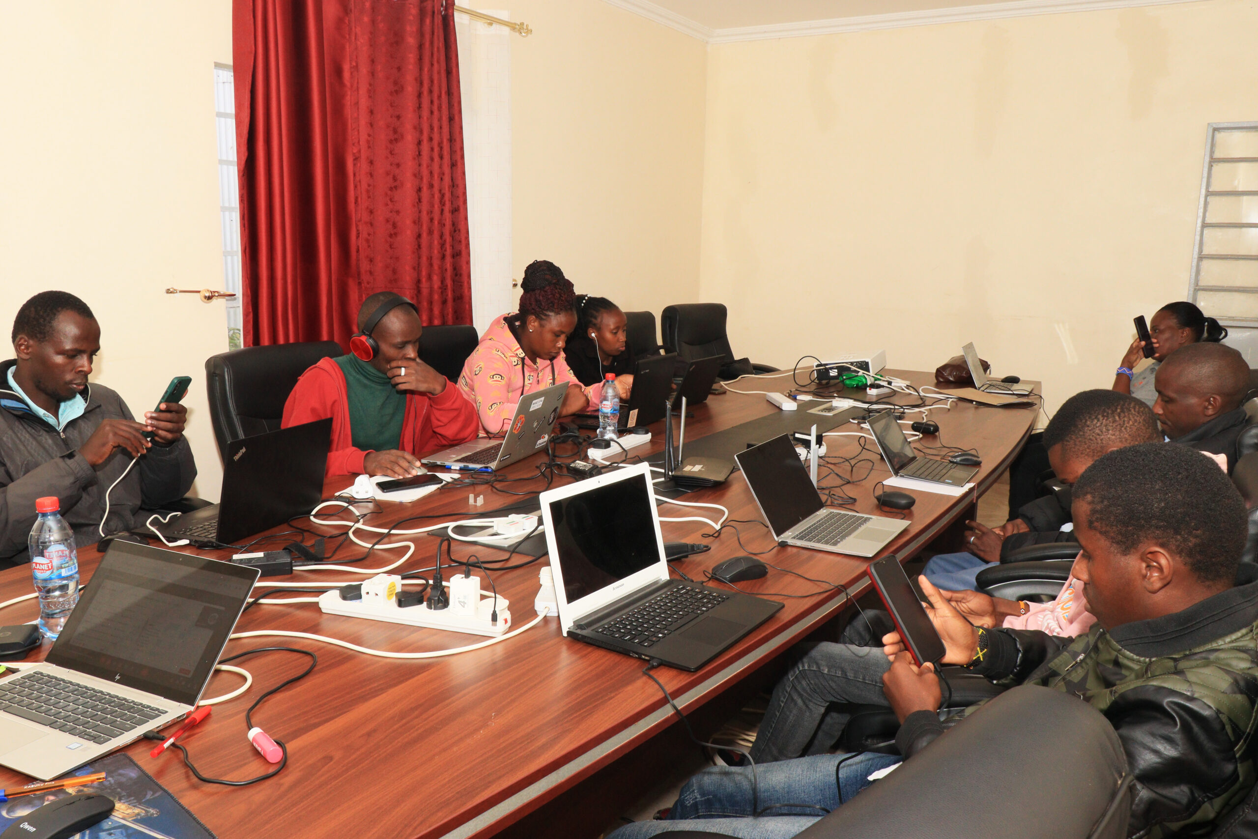
Facilitated by ALIN and supported by the Humanitarian OpenStreetMap Team, the Sipili community held
a two-day community mapathon at ALIN’s (Knowledge) Centre. A “Maarifa Centre” is a community
space equipped with appropriate ICT equipment and tools to bridge the digital divide by enhancing
knowledge creation, access, dissemination, and skills development. The Community Mapathon drew
participation from youth within the Ng’arua Maarifa Centre in Sipili and its environment, marking a
collective effort in the mapping of the area. During the mapping sessions, community members received
training on how to use the mapping tools, fostering an environment where they interacted excitedly
with the mapping soft wares. Beyond the mere exploration of technology, these sessions have evolved
into platforms for community members to share their insights and knowledge about the geography of
the Sipili community.
Mr. Allan Wafula expressed excitement about the opportunity he had to explore mapping. “I am
thankful to ALIN for giving me this opportunity to explore mapping. I had never done mapping before. It
was my first time doing it and I found it so impressive and interesting,” Allan said excitedly.
Mr. Joseph Kanyi, a local Cybercafé owner, shared his experience during the first mapathon in Sipili. “I
got the opportunity to learn a new skill. Most of the time, we see maps on Google Maps and wonder
who and when they were generated. I am thankful that we have been given the opportunity to know
how the maps, specifically OpenStreetMap are generated and to be involved in the mapping.” said
Kanyi.
This collaborative effort not only utilizes horning-mapping skills but also holds special significance,
serving as a crucial step in identifying optimal locations for the telecommunication equipment for the
proposed ALINet Community Network. The community network establishment is timely as it supports
the Kenya government’s efforts in establishing 25,000 community hotspots in line with its Digital
Strategy. Beyond the Map project highlights community collaboration, demonstrating how technology
can empower communities and bridge the digital divide. As Sipili Community members navigate the
OpenStreetMap, it will not only be spatial awareness but also have a sense that they played a significant
role in shaping the OpenStreetMap.